

Hiking Mount Satima via Dragon’s Teeth
Mount Satima was my introduction to the northern Aberdares. The approach through Rhino Gate takes you from open grassland into dense forest, then out into wide moorland. By Twin Rocks, the landscape has opened up and you begin to see what you’ve come for.
The trail heads through small valleys and jagged rock formations towards the summit, with Dragon’s Teeth stealing much of the attention along the way. I kept finding reasons to stop and look back. Each view seemed to reveal a little more than the last.
Rain followed much of my climb, with pauses just long enough to get my hopes up. The return brought better weather and a chance to enjoy the places I had trudged past the day before.
Getting to Twin Rocks
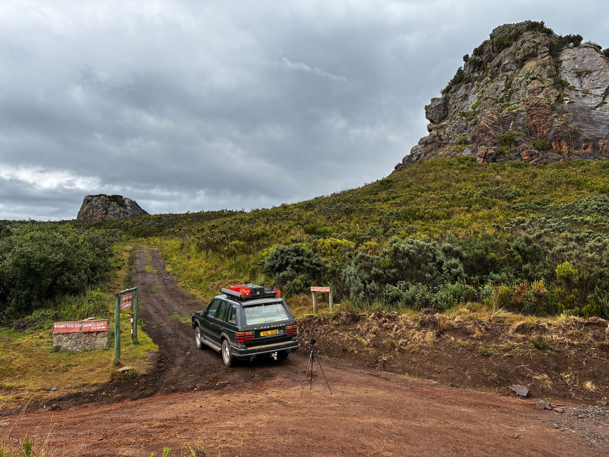
This hike starts at Twin Rocks, approached on this trip from Nanyuki through Rhino Gate. It’s a modest entrance to a rather extraordinary landscape.
Inside the park, the road winds through forest and onto hillsides covered in low moorland shrubs. The twin rocks appear well before you reach them, piercing the landscape and announcing their presence. There’s little doubt about how the place got its name.
At the trailhead, a large parking area and a sign mark the picnic site and the Ol Donyo Satima trail. The campsite sits at the foot of the rock outcrops, with few facilities. The small toilet structure looked rundown and disused during my visit, so check current arrangements before planning a stay.
A gentle start into the moorland
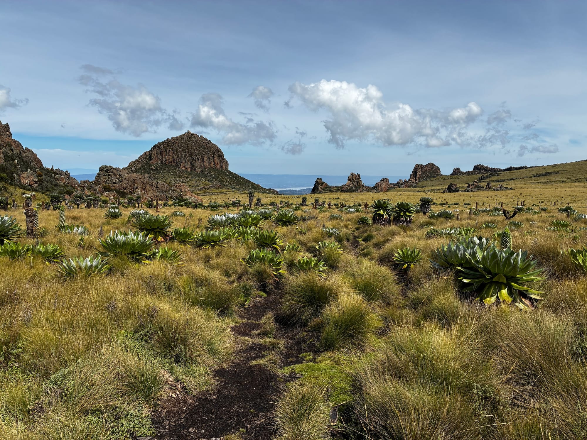
The trail welcomes you gently. A mostly flat 4×4 track gives you time to settle into the walk before the climb through the moorland grasses begins.
Around where the track ends, the first jagged rocks hint at what lies ahead. It’s worth turning around here: Twin Rocks and the campsite are already taking on a different shape below.
After the initial climb, the route drops into a small valley, crosses a tiny stream and heads up a steeper slope. Nipple Rock stands in the middle ground, with Dragon’s Teeth behind it. There is plenty to hold your attention, even before you reach the main attraction.

Walking through Dragon’s Teeth
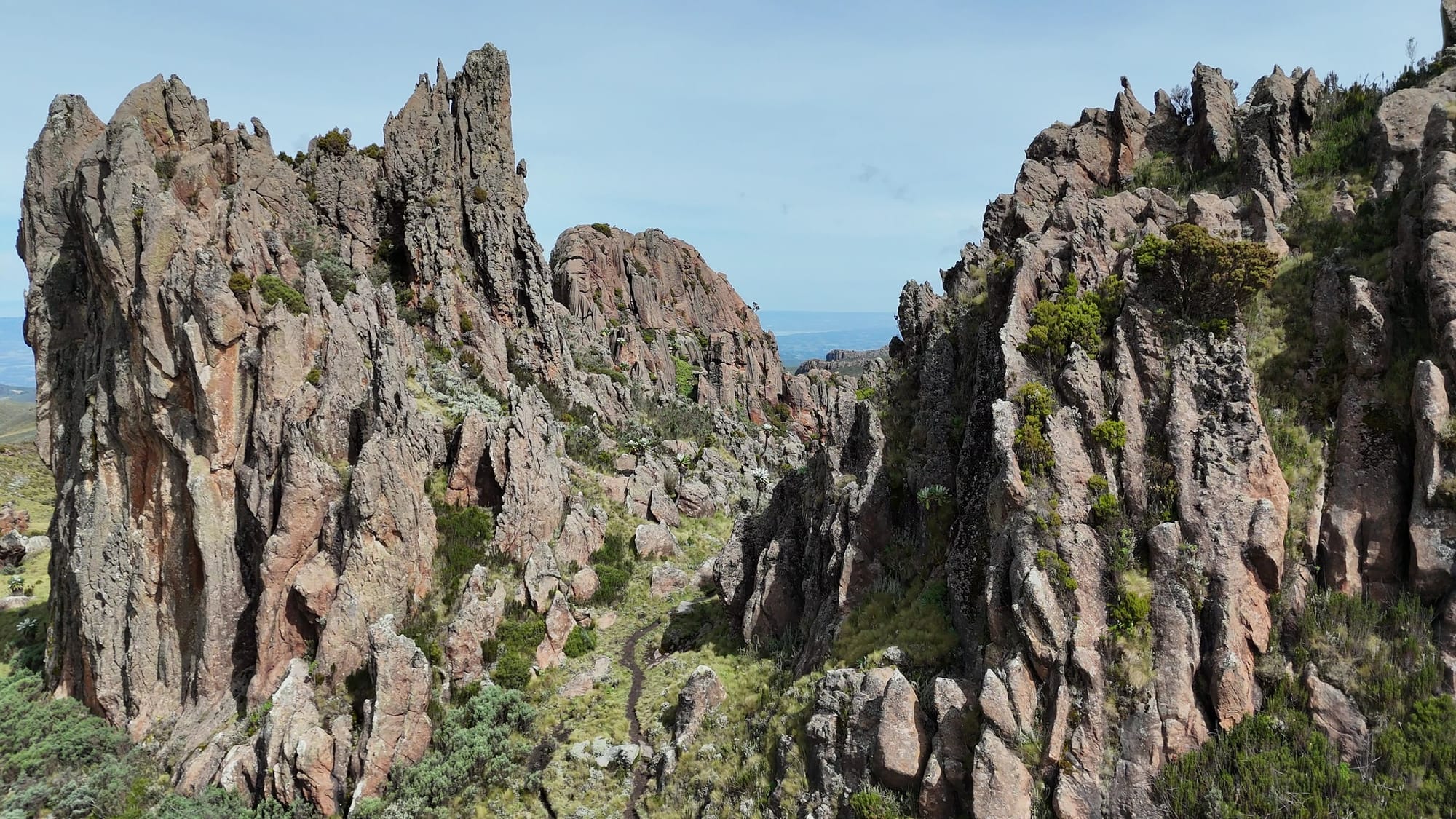
Dragon’s Teeth had me pinching myself. Under a grey sky, the jagged outcrops have a sombre presence above the wet grasses. I stopped during a break in the rain, a little cold but very glad to be there.
The trail climbs and then drops through a gap in the rocks, almost like a gate. On the other side, open moorland returns and the path snakes gently through the grasses.
Keep looking back along this stretch. The view seems to zoom out as you walk: first the rocks beside you, then the whole formation, then the surrounding hills. I’m a slow hiker at the best of times; this wasn’t helping.
The climb towards the summit
Beyond Dragon’s Teeth, the route continues across open ground and up the ridges towards Satima. Gentle stretches break up the climbs, but the easy start rather undersells the effort ahead, especially with a heavy backpack.
The ridges leave you exposed to the weather. On my visit, drizzle became repeated downpours, with only short breaks between them. By the summit, my boots were soaked and stopping meant getting cold. Hot tea had rarely been so welcome.
Allow time for the scenery as well as the climb. There are too many good places to pause to treat this as a straight march to the top. An early start gives you room to enjoy them without leaving the final ascent too late.

Returning through the rocks
Coming down the following day was a joy. The weather stayed pleasant, the walking was mostly downhill, and the rain cover could finally stay packed away.
Dragon’s Teeth looked different from the opposite direction. With time to linger, I could properly appreciate the shapes of the rocks and the spaces between them. It felt a little like wandering into another world.
The summit gives this hike a destination, but the changing views between Twin Rocks and Dragon’s Teeth are what have stayed with me. They’re worth taking your time over, whichever way you’re walking.

Field Notes
| Detail | Notes from this visit |
|---|---|
| Starting point | Twin Rocks, approached through Rhino Gate |
| Route | Twin Rocks to Mount Satima via Dragon’s Teeth, returning the same way |
| Terrain | Vehicle track at the start, moorland paths, valley crossings and ridge climbs |
| Main highlights | Twin Rocks, Nipple Rock, Dragon’s Teeth and the open moorland |
| Conditions | Prolonged rain on the ascent; pleasant weather on the return |
| Facilities | Basic trailhead campsite; toilet structure appeared disused |
| Phone signal | Intermittent at Twin Rocks during this visit |
Planning your hike
- Start early and allow time for the scenery as well as the summit.
- Pack waterproof layers and protect the contents of your bag. The rain on this trip lasted much longer than a passing shower.
- Carry a warm layer for stops. Wet feet and clothing made the summit particularly cold.
- If camping, keep sleeping gear dry and bring enough warm clothing for the night.
- Check current access, guide and camping arrangements with the park before travelling.
My visit included a night near the summit. A planned onward descent via Wandare was abandoned because of the weather, so this account covers the Twin Rocks route only.
Editing reminder: Add a verified route map or GPX embed here. Insert distance, elevation gain and walking time after checking the recorded track.
Find the trail in Savanna Guides
The Mount Satima trail is available in the Savanna Guides app. Find it in the app as you plan your hike, and download Savanna Guides from Google Play or the App Store below.


Watch the hike
Watch the Mount Satima hike on YouTube — link to be added.